CentipedeRTK compared with Trimble VRS Now and HxGN SmartNet| CentipedeRTK | Trimble VRS Now | HxGN SmartNet |
|---|
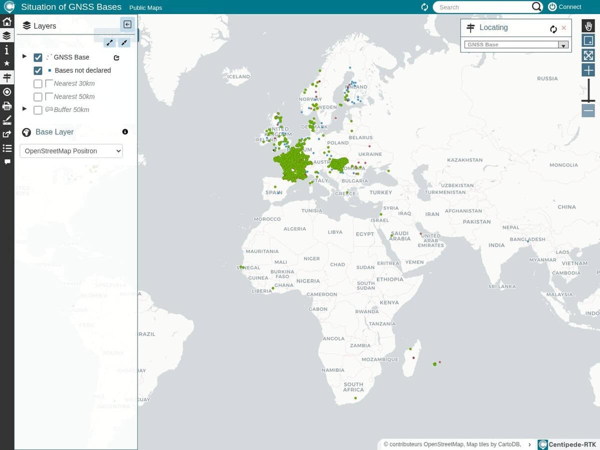
| Network model: A collaborative network of open GNSS bases run by public institutes, individuals and private actors such as farmers. The aim is to cover all of metropolitan France. A caster is available at crtk.net on port 2101, and you normally use the closest base. | Network model: A commercial network of permanent reference stations with corrections computed for the rover position by Trimble software. | Network model: A commercial subscription network built on Leica GNSS Spider software and managed by Leica. |
| Cost and licence: Free to use inside the coverage area. The network database is under the Open Database Licence and the documentation under Creative Commons BY-SA 4.0. The project is supported financially by INRAE. | Cost and licence: Paid subscription, with prices not published on the vendor page. | Cost and licence: Paid subscription, with prices not published on the pages consulted. |
| Openness and extension: Open source software and open hardware are used. Anyone can build and declare a base, and the documentation covers antenna siting and receivers such as the Mosaic X5, the UM980 and the F9P. Open RTKBase software can run on a Raspberry Pi. | Openness and extension: Proprietary service. You cannot add stations to it. | Openness and extension: Proprietary service. You cannot add stations to it. |
| Reliability and liability: Quality depends on the individual contributor stations. INRAE and the contributors accept no liability for the content of the shared RTCM3 corrections. | Reliability and liability: Commercial service with a satellite backup called xFill when the network connection is lost. Accuracy is rated at better than 2 cm. | Reliability and liability: Commercial service monitored 24 hours a day by the vendor. Accuracy figures were not found on the pages consulted. |
| Coverage: Strongest in France. The site owner reports growth in Hungary and Switzerland, with a few bases in Europe and North America. Check the live map for the nearest base. | Coverage: Much of North America, Europe, Australia and New Zealand where cellular coverage exists. | Coverage: Regional services, including SmartNet North America and a UK service, so coverage depends on the country. |
| When to choose it: Choose it for agriculture, robotics, drones or education in covered regions when a free centimetre-level source is acceptable and a nearby base exists. | When to choose it: Choose it when a supported commercial solution with broad geographic coverage is required. | When to choose it: Choose it when you use Leica receivers or need a contract-backed service in a region it covers. |