… or when bureaucracy or regulation takes over common sense in the airport?

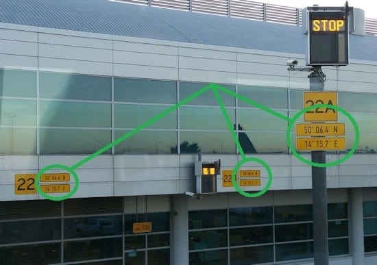
These latitude/longitude coordinates plates, all the same, are all printed repeatedly, 3 to 5 meters away from each other. In one blink of an eye, this is what you see:
One may think that indicating more frequently is more convenient than less because you see one plate faster, no?
… well … that is very arguable: it can be confusing (“Why different plates? Are they all the same? Should I read all to decide? …”)
Really helpful, just bureaucracy or regulation?
As a reminder (the only technical part in this blog)
XX° xx,xy‘ one unit variation of y = 2nd decimal place of minutes = 1.1km !!!
… so likely all the airport building has exactly the same plates over and over (lower printing cost because of volumes? 😉
So in fact, precision is just enough to tell to the pilot “look at your map, you are indeed this this airport”.
Could a real pro pilot confirm or explain in the comments below?