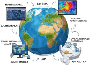
Our dedicated, updated repository of news and patents related to Geographic Information System (GIS) to track advancements in spatial data technologies, analytical methodologies, and application domains. By systematically aggregating and curating the latest innovations in georeferencing techniques, remote sensing integration, geospatial data management, and GIS logiciel development, our repository enables experts to monitor emerging trends in spatial querying, topology optimization, and geodatabase architectures. It facilitates timely access to breakthroughs in thematic mapping, spatial interpolation algorithms, and network analysis tools, while also capturing propriété intellectuelle développements qui stimulent l'évolution des infrastructures de données spatiales et des solutions de renseignement géospatial.
Voici notre dernière sélection de publications et de brevets mondiaux en anglais sur les systèmes d'information géographique (SIG), parmi de nombreuses revues scientifiques en ligne, classées et axées sur les données spatiales, la géoréférence, la télédétection, la cartographie, l'analyse spatiale, les données géospatiales, l'élévation numérique, le système de coordonnées, Raster Data, GPS, Global Positioning System, Topology, Digital Elevation Model, Geodatabase, Map Project, Thematic Map, Spatial Query, Geocoding, Spatial Join, Terrain Model, Spatial Interpol, Data Visual, GIS, Global Position, Positioning System, Spatial Data and Geospatial Intelligenc.
Apparatus and method for providing cellular and non-cellular communication services by using low orbit satellite
Patent published on the 2026-07-02 in WO under Ref WO2026142301 by THINKWARE CORP [KR] (Han Taekyu [kr])
Abstract: Provided in embodiments of the present disclosure is a location management apparatus for registering and managing terminal-specific location-related information. The location management apparatus may comprise: a memory for storing instructions; at least one processor; and a communication circuit. When executed by the at least one processor, the instructions may cause the location management apparatus to: receive, through the communication circuit, an inquiry message requesting the location of a [...]
Our summary: The apparatus manages terminal-specific location-related information for both cellular and non-cellular services. It receives inquiries about terminal locations and checks a memory table for stored data. Based on the presence or absence of information, it responds with either the location data or an error message.
location management, low orbit satellite, communication services, terminal-specific information
Patent
Synergism of artepillin c with naringenin and beta carotene
Patent published on the 2026-07-02 in WO under Ref WO2026143239 by BOARD OF SUPERVISORS OF LOUISIANA STATE UNIV AND AGRICULTURAL AND MECHANICAL COLLEGE [US] (Rebello Candida [us], Ramanathan Guru [us], Coulter Ann [us], Greenway Frank [us])
Abstract: The present invention is drawn towards a composition comprising Artepillin C, naringenin, a carotenoid, and a pharmaceutically acceptable carrier, wherein the carotenoid is selected from the group consisting of beta-carotene, lycopene, or lutein, and methods of using the composition for local fat reduction and/or treating a subject afflicted with a metabolic disorder.[...]
Our summary: The invention describes a composition that includes Artepillin C, naringenin, and beta-carotene. This composition is aimed at local fat reduction and treating metabolic disorders. It utilizes a pharmaceutically acceptable carrier for effective delivery.
Artepillin C, naringenin, beta-carotene, metabolic disorder
Patent
Vertical federated learning in a wireless communication system
Patent published on the 2026-07-02 in WO under Ref WO2026139154 by LENOVO INT COOEPERATIEF U A [NL] (Karampatsis Dimitrios [gb], Pateromichelakis Emmanouil [de])
Abstract: Various aspects of the present disclosure relate to a first network entity for wireless communication. The first network entity may be configured to, capable of, or operable to receive, from a second network entity, a registration request to register the second network entity for participating in a vertical federated learning, VFL, operation, wherein the registration request comprises an indication of a VFL capability of the second network entity; and transmit, to the second network entity, a re[...]
Our summary: The content discusses a first network entity in a wireless communication system. It describes the process of receiving a registration request from a second network entity for vertical federated learning. The first network entity then transmits a registration response to the second network entity.
Vertical Federated Learning, Wireless Communication, Network Entity, Registration Request
Patent
Efficient transfer of augmetned reality objects
Patent published on the 2026-07-02 in US under Ref US20260187939 by INT BUSINESS MACHINES CORPORATION [US] (Acharya Chandrashekar Charan [in], Gelli Prasanth [in], Jonnavithula Nikhil Sai Krishna [in], Rahul Raja [in])
Abstract: [0000] A computer-implemented method includes generating a list of statically defined augmented reality objects using a central server. A set of features defining at least one augmented reality object of the list of statically defined augmented reality objects is extracted from the at least one augmented reality object using the central server. A list of reusable features from the set of features is generated at the central server. The reusable features are transmitted from the central server to[...]
Our summary: A method for transferring augmented reality objects involves generating a list of statically defined objects on a central server. Reusable features are extracted and transmitted to client devices, each assigned a unique identifier. An instruction file is provided to define AR objects using these unique IDs and their parameters.
augmented reality, central server, reusable features, client device
Patent
Method for determining values of a convolution kernel for an iterative statistical reconstruction procedure used in pet imaging
Patent published on the 2026-07-02 in US under Ref US20260187886 by CZESTOCHOWA UNIV OF TECHNOLOGY [PL] (Cierniak Robert [pl])
Abstract: [0000] A method for determining a convolution kernel for an iterative statistical algorithm based on a continuous-to-continuous data model for image reconstruction from radiation measurements obtained in emission tomography, specifically in a Positron Emission Tomography (PET) scanner. The method improves the resolution of reconstructed images, reduces the radiation dose absorbed by patients during PET examinations, and/or shortens the measurement acquisition time without significant loss in the[...]
Our summary: The method determines a convolution kernel for iterative statistical reconstruction in PET imaging. It enhances image resolution, reduces patient radiation dose, and shortens acquisition time. The design considers statistical properties of measurement signals to maintain functional image quality.
convolution kernel, iterative statistical reconstruction, Positron Emission Tomography, image quality
Patent
Mobile application and web experience for data collection and logbook creation
Patent published on the 2026-07-02 in US under Ref US20260187161 by JEFF BLOOD FLY FISHING LLC [US] (Blood Jeffrey L [us])
Abstract: [0000] A mobile device receives voice input from a user during a fishing event. The mobile device processes the voice input using natural language processing and natural language understanding to identify trigger words. The mobile device performs actions based on the trigger words. The mobile device may drop a virtual pin on a map to mark a location. The mobile device retrieves data from the internet related to the fishing event. The mobile device may log data points, including GPS coordinates, [...]
Our summary: A mobile device uses voice input to log fishing events through natural language processing. It marks locations on a map and logs various data points related to the fishing activity. The compiled data is stored in an electronic logbook and managed via cloud storage.
Natural Language Processing, Data Collection, Mobile Application, Cloud Storage
Patent
Analysis of remote sensing monitoring status and restoration models for newly added mine environmental restoration in Anhui Province
Published on 2026-07-01 by @OXFORD
Abstract: AbstractAnhui Province is a major mineral resource area of China, which has facilitated economic growth. With the promotion of nationwide green mine construction, mining has become more scientific and environmentally friendly. According to Geographic Information System (GIS) and remote sensing (RS) technologies with high-resolution RS data, environmental restoration of Anhui Province mines in 2017 was investigated through RS interpretation, interactive verification, and on-site investigations. T[...]
Our summary: This study analyzes the status of remote sensing monitoring and restoration models for mines in Anhui Province. It utilizes GIS and high-resolution RS data to assess environmental restoration efforts and challenges. Recommendations are provided to improve mine management and support sustainable mineral resource use.
Remote Sensing, Environmental Restoration, Geographic Information System, Mine Management
Publication
Rural e-commerce logistics path optimization method by carbon emission costs and CCSO
Published on 2026-06-25 by @OXFORD
Abstract: AbstractThis study tackles nonlinear programming challenges caused by the dual constraints of sparse, discrete rural e-commerce logistics networks and low-carbon time requirements. The study develops a path optimization model that combines a carbon tax mechanism with dynamic scheduling strategies. Traditional swarm intelligence algorithms often fall into local optima and lose population diversity in high-dimensional discrete spaces. To address these issues, this study proposes an improved Chicke[...]
Our summary: This study presents a path optimization model for rural e-commerce logistics that incorporates carbon emission costs. It introduces an improved Chicken Swarm Optimization (CCSO) to enhance global search capabilities. The results indicate significant reductions in operational and carbon emission costs through optimized routing.
path optimization, carbon emissions, Chicken Swarm Optimization, rural logistics
Publication