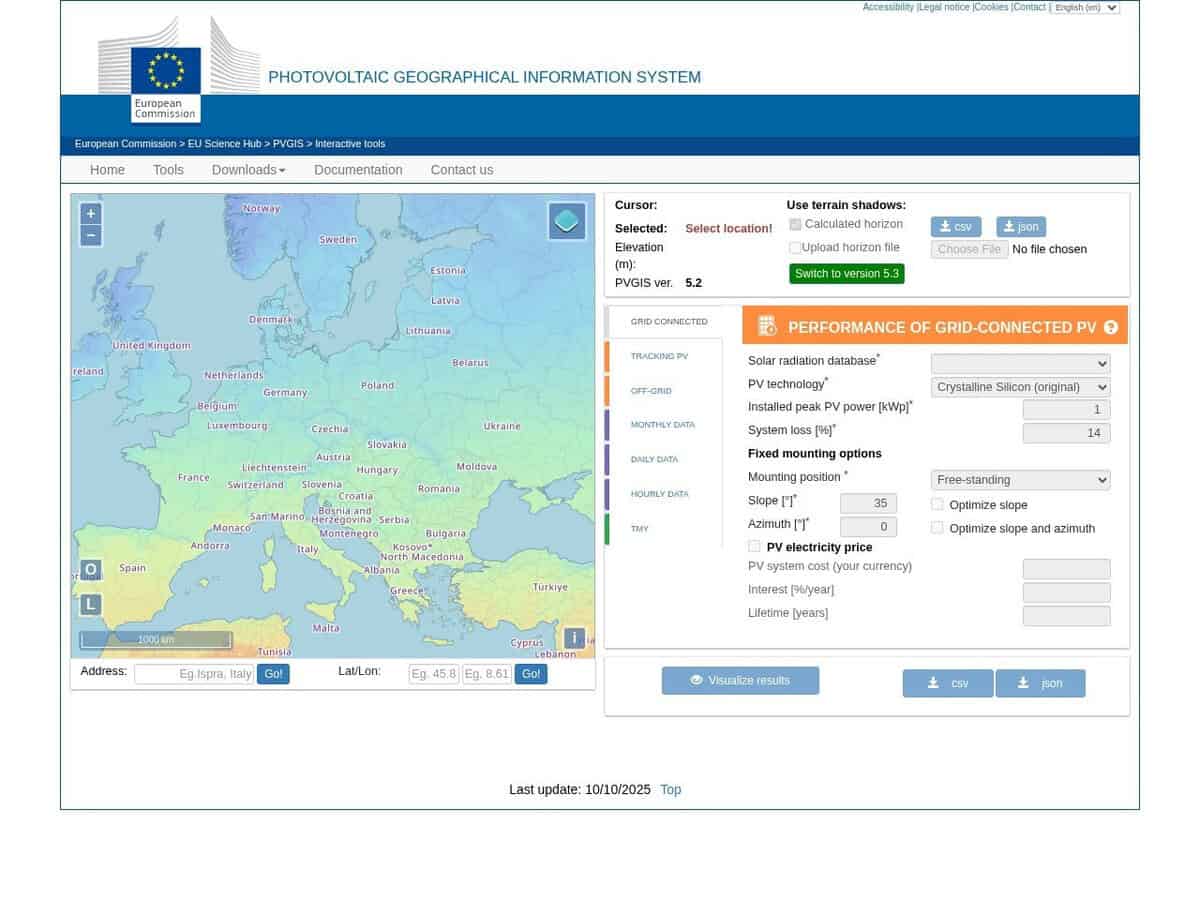
Select you location on a world map, define your solar panels mounting style and orientation, and it will calculate the power produced over the day, month or year. Uses various GIS databases and models.
The PVGIS API 5.2 provides programmatic access to the European Commission’s Joint Research Centre solar resource and photovoltaic (PV) performance databases, enabling automated retrieval of high-resolution meteorological and energy data. It delivers granular datasets including hourly solar irradiance, ambient temperature, and wind speed, alongside calculated PV power output for grid-connected and stand-alone systems. The service supports technical workflows through:
- Typical Meteorological Year (TMY) generation for building and energy simulations.
- Site-specific horizon profiles to account for topographical shading effects.
- Performance estimates adjusted for specific PV technologies like Crystalline Silicon and Thin-film.
- Programmatic endpoints for JSON, CSV, and XML data integration into external applications.
Tip: this tool has been derived into several variants by many commercial sites and can therefore look familiar.