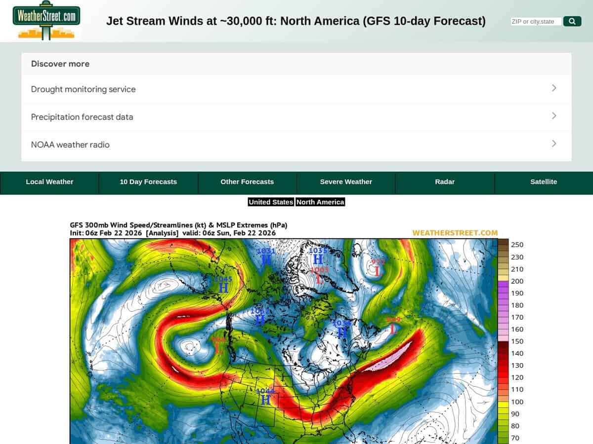
A current situation and 10 days forecast of the jetstream location and intensity with wind speeds in knots. The WeatherStreet GFS Jetstream Wind Forecast provides high-altitude meteorological data visualizing wind velocity and direction at the 250 mb pressure level across North America. Utilizing the Global Forecast System (GFS) numerical model, the service generates a series of synoptic charts that track the polar and subtropical jet streams over a multi-day forecast horizon.
It includes North America and part of South America. Can be focused to US only for more local details.
Useful for high altitude activities or long time-lapse astronomy photography. Aerospace engineers and flight operations specialists utilize these forecasts to optimize transcontinental flight paths, leveraging tailwinds to reduce fuel consumption and identifying potential clear-air turbulence zones to ensure structural integrity. In the fields of science and innovation, the data is applied to:
- Predicting the trajectory and intensification of mid-latitude cyclones that disrupt manufacturing supply chains and logistics.
- Modeling high-altitude kinetic energy for innovation in airborne wind energy (AWE) systems.
- Analyzing atmospheric blocking patterns to forecast extreme temperature events affecting industrial cooling and energy grid loads.