Jetstream North America 10d Forecast Map compared with Windy and SkyVector| 北美喷射气流10天预报图 | 风 | SkyVector |
|---|
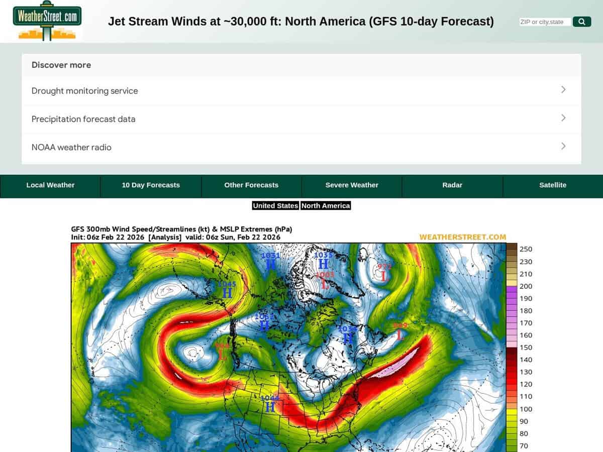
| Forecast source: The page is built on the GFS numerical model and shows a 10 day forecast of jet stream winds. The map is labelled with a 300 mb pressure level, given as about 30,000 ft. | Forecast source: Windy lists ECMWF, GFS and NEMS as forecast models on its site. The user can therefore switch between models, which a single GFS chart does not allow. | |
| Scope of the service: It is a single purpose chart of high altitude wind for one region, with no other weather layers on the page. | Scope of the service: Windy is an animated worldwide weather map with 50+ layers, weather radar and satellite imagery, plus spot forecasts. | Scope of the service: SkyVector provides aeronautical charts, online mapping and an enhanced flight planning suite, with weather and data overlays. It was founded in 2006. |
| 地理覆盖范围: The maps cover North America, with a link to a US only map for more local detail. | 地理覆盖范围: The map covers the whole world. | 地理覆盖范围: Its aeronautical charts are described as worldwide. |
| Aviation data: It gives only upper level wind speed and direction, which is the input for en route wind and turbulence assessment. | Aviation data: Windy shows METAR, TAF and NOTAMs for any airport, and SYNOP codes from stations and buoys. | Aviation data: SkyVector adds airport information and FBO listings to its charts. |