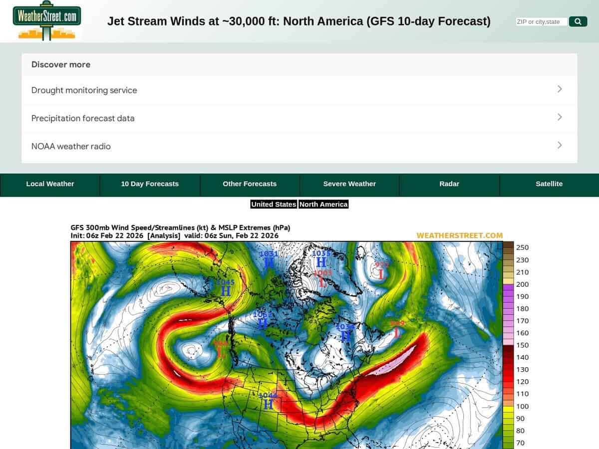
제트기류의 위치와 강도에 대한 현재 상황 및 향후 10일간의 예보(풍속은 노트 단위)입니다. The WeatherStreet GFS Jetstream Wind Forecast provides high-altitude meteorological data visualizing wind velocity and direction at the 250 mb pressure level across North America. Utilizing the Global Forecast System (GFS) numerical model, the service generates a series of synoptic charts that track the polar and subtropical jet streams over a multi-day forecast horizon.
북미와 남미 일부 지역을 포함합니다. 더 자세한 지역 정보를 원하시면 미국에만 초점을 맞출 수 있습니다.
고고도 활동이나 장시간 타임랩스 천체 사진 촬영에 유용합니다. 항공우주 엔지니어와 비행 운항 전문가들은 이러한 예측을 활용하여 대륙 횡단 비행 경로를 최적화하고, 순풍을 이용하여 연료 소비를 줄이며, 구조적 안전성을 확보하기 위해 잠재적인 난류 영역을 식별합니다. 과학 및 혁신 분야에서 이 데이터는 다음과 같은 분야에 적용됩니다.
- Predicting the trajectory and intensification of mid-latitude cyclones that disrupt manufacturing supply chains and logistics.
- 공중 풍력 에너지(AWE) 시스템 혁신을 위한 고고도 운동 에너지 모델링.
- Analyzing atmospheric blocking patterns to forecast extreme temperature events affecting industrial cooling and energy grid loads.