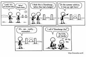
コミック:古代の投稿から、夏至の追跡に関する初期の記録が明らかに
Our smiling view on today’s news: Researchers have uncovered a rudimentary monument featuring two posts that align with the sun
Our smiling view on today’s news: Researchers have uncovered a rudimentary monument featuring two posts that align with the sun

When drones permits views that even helicopters would not. Our top picks. World First Everest Skiing from Summit without Oxygen

This week: flapping wing, electromagnet, microcontroller, UAV, security monitoring, UAV detection, geographic area, sensitivity adjustment, Object Detection, State Space Model,

This week: thermal conductivity, polymer composites, filler networks, bimodal systems, AI tasks, predictive algorithm, bitwise operations, non-transitory storage, placenta-on-a-chip, fluidic

This week: access control, personnel records, user management, credential mapping, NFC, payment transactions, digital identity, authentication, multi-factor authentication, biometric data,

This week: charcuterie, serving, design, tools, data transmission, encryption, health data, distributed storage, data processing, packet transmission, node signature, private

This week: LiDAR, photodetector, near-field detection, optical receiver, LiDAR, performance evaluation, point cloud, test target, time-of-flight, LiDAR, photon detection, distance
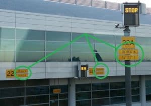
… or when bureaucracy or regulation takes over common sense in the airport? These latitude/longitude coordinates plates, all the same,