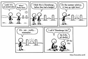
Fumetti: Antichi post rivelano il monitoraggio anticipato del solstizio
Il nostro punto di vista con un sorriso sulle notizie di oggi: alcuni ricercatori hanno scoperto un monumento rudimentale costituito da due pali allineati con il sole
Il nostro punto di vista con un sorriso sulle notizie di oggi: alcuni ricercatori hanno scoperto un monumento rudimentale costituito da due pali allineati con il sole

This week: decarbonisation, life-cycle assessment, urban microclimate, resilience optimization, contrail formation, atmospheric radiative forcing, flight trajectory optimization, weather parameters, volumetric

This week: UAV, flight termination, control network, electronic speed controllers, biopesticides, natural oils, precision agriculture, regulatory compliance, microwave radiometer, flicker

This week: health therapies, light arrays, hydrogen inhalation, oxygen bubbler, model compression, deep neural networks, batch normalization, loss function, motorized
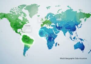
This free innovation.world choropleth world map tool permits to visualize and compare any country-by-country data directly in your browser. With

This week: Lidar, 3D object detection, autonomous vehicle, point cloud data, LiDAR, aquatic environment, diode lasers, time-of-flight, robot path planning,

This week: Hypernetworks, content recontextualization, Low-Rank Adaptation, generative model, version control, natural language processing, artificial intelligence, content tracking, few-shot learning,
This week: Geolocation, Caching, Access Point, Network Identifiers, threat assessment, artificial intelligence, generative AI, domain-specific data, Natural Language Processing, Summarization,