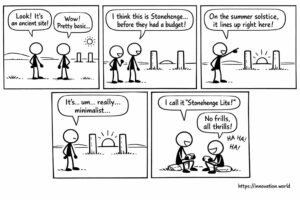
Fumetti: Antichi post rivelano il monitoraggio anticipato del solstizio
Our smiling view on today’s news: Researchers have uncovered a rudimentary monument featuring two posts that align with the sun
Our smiling view on today’s news: Researchers have uncovered a rudimentary monument featuring two posts that align with the sun
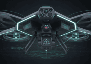
This week: collision avoidance, stationary object detection, transponder system, traffic alert, target following, unmanned aerial vehicle, panoramic imaging, object tracking,

This week: deep learning, consumer behavior, low-carbon economy, pattern recognition, collision avoidance, stationary object detection, transponder system, traffic alert, image

This week: location management, low orbit satellite, communication services, terminal-specific information, Artepillin C, naringenin, beta-carotene, metabolic disorder, Vertical Federated Learning,
This week: focal plane array, lidar device, signal light beam, interference light beam, collision avoidance, stationary object detection, transponder system,

This week: focal plane array, lidar device, signal light beam, interference light beam, autonomous vehicles, artificial intelligence, data collection, control