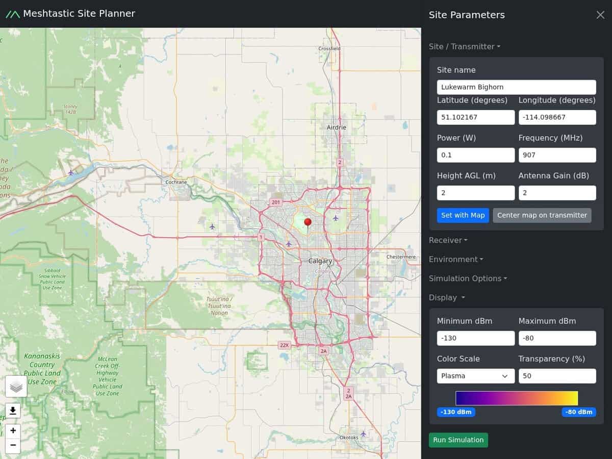
Meshtastic Range Simulator (Site Planner) compared with Radio Mobile and CloudRF| Meshtastic 靶场模拟器(场地规划器) | Radio Mobile | CloudRF |
|---|
| Purpose and field of use: The planner predicts coverage for Meshtastic LoRa nodes. It suits mesh deployment, emergency communication and IoT range checks. Several sites can be added to one scenario. | Purpose and field of use: Radio Mobile simulates RF propagation for radio planning. It handles general radio links and networks, with voice net and data net topologies, and is not limited to LoRa. | Purpose and field of use: CloudRF is a commercial service for radio planning with a web interface and an API. It is used well beyond LoRa, and offers 10 propagation models. |
| Propagation model and terrain data: The page metadata names the ITM (Longley-Rice) model. Terrain comes from NASA SRTM at about 90 m accuracy, and buildings and trees are ignored unless a clutter height is entered. | Propagation model and terrain data: It uses the ITS Irregular Terrain Model (Longley-Rice) over 20 to 20,000 MHz. Elevation sources include SRTM 1 and 3, DTED 0 to 2, GTOPO30, GLOBE and BIL files. | Propagation model and terrain data: Models listed include COST, ITU-R and ITM, with reliability, context and diffraction options. Clutter items can be stored per plan. |
| 输入和输出: Inputs are site name, coordinates, antenna height, power, frequency and gain, plus receiver sensitivity (-130 dBm for LongFast). The output is a colour-coded RSSI coverage map. | 输入和输出: Inputs are network parameters such as transmit power, line loss, antenna gain, propagation loss and receiver sensitivity for each unit. Link parameters are set in detail for each unit. | 输入和输出: Requests can be sent through an OpenAPI 3.0 REST API. Resolution and radius depend on the plan, from 1.0 MP and 10 km up to 6.0 MP. |
| Openness and cost: Free and open source, with the code on GitHub. Calculation runs in the browser on your device, so no site data leaves the machine. | Openness and cost: Free for the amateur radio community according to the author page. The software is by Roger Coudé, VE2DBE, and a separate companion site is kept by PE1MEW. | Openness and cost: Paid. Plans come in three tiers, with a sandbox limited to Ibiza and credits for occasional use. |
| 何时选择它: Choose it for a quick, free check of Meshtastic node placement. Validate the result with field tests, since clutter is only approximated. | 何时选择它: Choose Radio Mobile for multi-link networks and detailed link budgets, where you accept a classic desktop tool and manual set-up. | 何时选择它: Choose CloudRF when planning must be automated through an API, or when you need more models and larger areas than the free tools offer. |