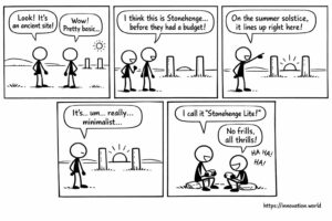
만화: 고대 게시물에서 초기 하지 추적법이 드러났다
오늘 뉴스에 대한 우리의 긍정적인 시각: 연구원들이 태양과 일렬로 정렬된 두 개의 기둥이 있는 원시적인 기념물을 발견했습니다.
A GPS receiver computes its position from the travel time of signals sent by at least four satellites. Three fix the location, the fourth corrects the receiver clock. Accuracy depends on satellite geometry, atmospheric delay and multipath, and it improves from metres to centimetres with differential or real-time kinematic corrections.
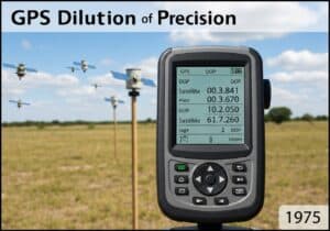 Research digests under this tag follow the main applications. Precision agriculture steers machines along repeatable lines. Autonomous vehicles combine satellite position with other sensors. Geographic information systems store what is measured. Two security digests, on information security and encryption, are tagged as well.
Two short articles add colour: a set of aerial views that only drones can capture, and a note on coordinate plates repeated across an airport. Related: 항공 그리고 농업.
오늘 뉴스에 대한 우리의 긍정적인 시각: 연구원들이 태양과 일렬로 정렬된 두 개의 기둥이 있는 원시적인 기념물을 발견했습니다.

When drones permits views that even helicopters would not. Our top picks. World First Everest Skiing from Summit without Oxygen

This week: UAV control, virtual flight space, object transportation, processor management, drone delivery, unmanned aerial vehicles, electronics circuit module, wing
This week: authentication, biometric, cryptography, zero-knowledge proof, shift register, gate driving circuit, display apparatus, compensation circuit, gastric cancer, dissemination probability,

이번 주 주제: 인증, 생체 인식, 암호학, 제로 지식 증명, 객체 클래스, 암호화, 문맥 데이터, 미디어 처리, 메타데이터, 시그널링, 프로토콜, 엔트로피, 랜덤 액세스,

This week: authentication, biometric, cryptography, zero-knowledge proof, object class, encryption, contextual data, media processing, TEAP, authentication, wireless networks, security capabilities,

This week: Lidar, piezoelectric actuator, mirror rotation, laser beam, LiDAR, optical processing, photosensitive units, depth information, LiDAR, scanning modules, vehicle,
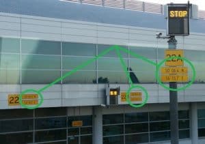
… 아니면 공항에서 관료주의나 규제가 상식을 압도할 때? 이 위도·경도 좌표판들은 모두 똑같지만,