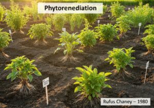
정밀 농업은 첨단 기술과 데이터 기반 접근 방식을 적용하여 미세한 공간적, 시간적 규모에서 작물 생산과 자원 관리를 최적화합니다. 원격 감지, 지리 정보 시스템, 가변 시비, 센서 네트워크를 통합하여 경작지의 변동성, 토양 상태, 작물 건강을 모니터링하고 관리합니다. 수확량 지도 작성, 정밀 관개, 현장 맞춤형 시비와 같은 기술은 투입 효율성을 높이고 환경적 지속가능성을 개선합니다. 이 분야는 농학, 공학, 데이터 과학이 융합되어 농업 시스템의 의사 결정 및 운영 효율성을 향상시킵니다. 본 자료집은 정밀 농업의 미래를 만들어가는 혁신, 방법론, 응용 사례를 상세히 기술한 최근 논문과 특허를 모두 수록하고 있습니다.
본 자료는 정밀 농업 분야의 전 세계 영문 논문 및 특허를 엄선하여 정리한 최신 자료입니다. 다양한 온라인 과학 저널에 게재된 자료들을 포함하며, 원격 감지, 가변 시비 기술, 토양 지도, 작물 모니터링, 수확량 지도, 농업용 드론, 정밀 관개, 센서 네트워크, 지리 공간 분석, 농장 관리, 현장 맞춤형 관리, 작물 모델, 토양 수분 센서, 정밀 비료, 무인 항공기, 정밀 식물 관리, 농업용 로봇, 경작지 변동성, 정밀 분무, 식물 표현형, 디지털 농업, 정밀 축산, 지리 정보 시스템, 원격 감지 영상, 정밀 영양 관리 및 스마트 농업 등 다양한 주제를 다룹니다.
Electromagnetically controlled flapping wing aerial device
Patent published on the 2026-06-11 in WO under Ref WO2026122076 by KATO KIYENGO JEFFREY [UG] (Kato Kiyengo Jeffrey [ug])
Abstract: The present invention relates to a flapping-wing aerial body capable of controlled flight using electromagnetically driven wing motion. The invention mimics the flight dynamics of insects, such as wasps and bees, by creating lift and thrust through the up-and-down movement of its wings. Electromagnets are employed to attract and release metallic plates connected to the wings, causing them to flap. This motion allows the aerial body to move in multiple directions, including forward, backward, lef[...]
Our summary: The invention is an electromagnetically controlled flapping wing aerial device that mimics insect flight dynamics. It uses electromagnets to drive wing motion for multi-directional movement and precise control. This design offers a compact and energy-efficient alternative to conventional drone technologies.
flapping wing, electromagnet, microcontroller, UAV
Patent
Security monitoring system
Patent published on the 2026-06-10 in EP under Ref EP4756768 by VERISURE SARL [CH] (Piedbois Julien [ch], Hackett Nicolas [ch])
Abstract: [0001] A security monitoring system of a premises and a method for operating such a security monitoring system. The method comprises monitoring a geographic area surrounding a building on the premises, detecting an unmanned aerial vehicle, UAV, in the monitored geographic area increasing the sensitivity of the security monitoring system in response to the UAV being detected in the geographic area.[...]
Our summary: A security monitoring system operates by monitoring the area around a building. It detects unmanned aerial vehicles (UAVs) within this area. The system increases its sensitivity when a UAV is detected.
security monitoring, UAV detection, geographic area, sensitivity adjustment
Patent
Object detection system based on state space model and multi-scale attention
Patent published on the 2026-06-04 in WO under Ref WO2026113460 by CHONGQING WUHUAN EXPERIMENTAL INSTR CO LTD [CN] (Luo Fei [cn], Song Guolin [cn], Song Fei [cn], Peng Shixin [cn], Wu Qingjie [cn], Lin Guangxi [cn], Wei Xiaolin [cn])
Abstract: An object detection system based on a state space model and multi-scale attention. The object detection system has a state space model (a Hazy-Mamba model) that is an innovative framework based on a MambaYOLO model, integrates an HAFE module and an MAG module, and solves, by means of knowledge distillation technique, the problems of a low detection accuracy in a haze environment, excessive model complexity, and difficulty in adapting to the deployment on an unmanned aerial vehicle. The object de[...]
Our summary: The object detection system utilizes a state space model and multi-scale attention to enhance detection accuracy in haze environments. It integrates HAFE and MAG modules, achieving high mAP values while maintaining lightweight deployment for UAVs. The system adapts to environmental challenges, ensuring low false detection rates and robustness in low-visibility conditions.
Object Detection, State Space Model, Multi-Scale Attention, Knowledge Distillation
Patent
Method for acquiring return point, control device, unmanned aerial vehicle, and unmanned aerial vehicle control system
Patent published on the 2026-06-04 in WO under Ref WO2026112984 by ARASHI VISION INC [CN] (Ji Jingjing [cn], Peng Yang [cn], Hao Shiqi [cn], Zhang Heng [cn])
Abstract: The present embodiments disclose a method for acquiring a return point, a control device, an unmanned aerial vehicle, and an unmanned aerial vehicle control system. The method for acquiring a return point comprises: determining a return point of an unmanned aerial vehicle on the basis of at least one among a preset number of states of a target control device, the target control device comprising at least one of a first control device of the unmanned aerial vehicle and a second control device of [...]
Our summary: The method acquires a return point for unmanned aerial vehicles. It involves determining the return point based on states of a target control device. The target control device includes first and second control devices of the unmanned aerial vehicle.
return point, control device, unmanned aerial vehicle, control system
Patent
Unit of one manufacturing of a garment
Patent published on the 2026-06-04 in US under Ref US20260153854 by RESONANCE COMPANIES LLC [US] (Lenihan Lawrence [us], Gheorghe Christian [us])
Abstract: Unit of one manufacturing of a garment includes remote sensing an identity of a fabric component of a garment at a manufacturing apparatus of a garment manufacturing system, retrieving a unique identifier for the remotely sensed identity and transmitting a query to a process management platform with the unique identifier so as to receive in response, a set of manufacturing parameters within a digital artifact for the garment that are specific to the manufacturing apparatus. Unit of one manufactu[...]
Our summary: The unit of one manufacturing of a garment involves identifying fabric components using remote sensing. It retrieves a unique identifier to query a process management platform for specific manufacturing parameters. Observed metrics during operation are recorded and sent back to enhance the digital artifact.
garment manufacturing, remote sensing, process management, digital artifact
Patent
Dynamic hazard detection and demarcation in a factory
Patent published on the 2026-06-03 in EP under Ref EP4752852 by MILANO POLITECNICO [IT] (Urgo Marcello [it], Berardinucci Francesco [it])
Abstract: The dynamic demarcation of danger zones in a factory floor includes remote sensing an arrangement of objects on the factory floor, such as a proximity of one object to another object on the factory floor, or a proximity of an object on the factory floor to a location at which a human is proximate. Dynamic demarcation also includes determining a risk factor for the arrangement. Dynamic demarcation additionally includes comparing the risk factor to a threshold value. Finally, dynamic demarcation i[...]
Our summary: Dynamic hazard detection involves monitoring object arrangements on the factory floor. It assesses risk factors based on proximity to humans and other objects. When risks exceed a threshold, boundaries are established to enhance safety.
hazard detection, dynamic demarcation, remote sensing, risk assessment
Patent
Spatial Analysis and Spread Monitoring of a Population of Juniperus macrocarpa Sm. Across Coastal Dune Systems in Northern Tuscany (Italy)
Published on 2026-02-03 by Andrea Bertacchi, Diego Orazi, Stefano Bedini, Tiziana Lombardi @MDPI
Abstract: Background: Juniperus macrocarpa Sm. is a key shrub species of the Mediterranean coastal dune systems. The species, considered vulnerable, often shows fragmented or declining populations due to coastal erosion and human pressure. However, along a protected stretch of the northern Tuscany coast it displays an opposite trend, with an apparent expansion of the species. Methods: To assess recent population dynamics, we compared high-resolution aerial imagery from 2013 with UAV orthophot[...]
Our summary: The study analyzes the population dynamics of Juniperus macrocarpa in northern Tuscany s coastal dune systems. It compares aerial imagery from 2013 and UAV orthophotos from 2023, revealing significant increases in abundance and cover. Findings emphasize the species expansion under low disturbance conditions and the importance of geomorphological factors in coastal vegetation dynamics.
Spatial Analysis, UAV Orthophotos, Coastal Dune Systems, Population Dynamics
Publication
A No-Reference Multivariate Gaussian-Based Spectral Distortion Index for Pansharpened Images
Published on 2026-02-03 by Bishr Omer Abdelrahman Adam, Xu Li, Jingying Wu, Xiankun Hao @MDPI
Abstract: Pansharpening is a fundamental image fusion technique used to enhance the spatial resolution of remote sensing imagery; however, it inevitably introduces spectral distortions that compromise the reliability of downstream analyses. Existing no-reference (NR) quality assessment methods often fail to exclusively isolate these spectral errors from spatial artifacts or lack sensitivity to specific radiometric inconsistencies. To address this gap, this paper proposes a novel No-Reference Multivariate [...]
Our summary: This paper introduces a No-Reference Multivariate Gaussian-based Spectral Distortion Index (MVG-SDI) for assessing pansharpened images. The methodology utilizes a hybrid feature set combining First Digit Distribution and Color Moment features to quantify spectral distortion. Experiments demonstrate that MVG-SDI correlates better with full-reference benchmarks and maintains stability against specific spectral degradations.
No-Reference, Spectral Distortion, Pansharpening, Multivariate Gaussian
Publication