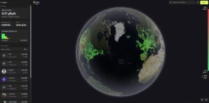
Mapa de radiación Radiaverse
Un mapa mundial interactivo de radiactividad/radiaciones realizado por los clientes de los productos conectados “RadiaCode” que registra automáticamente su área/trayectoria local.
Un mapa mundial interactivo de radiactividad/radiaciones realizado por los clientes de los productos conectados “RadiaCode” que registra automáticamente su área/trayectoria local.
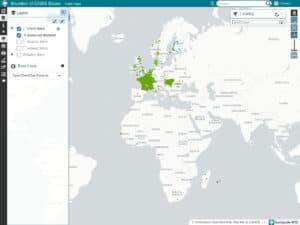
CentipedeRTK is a collaborative network of open GNSS bases available to anyone within the coverage area. The network is extended
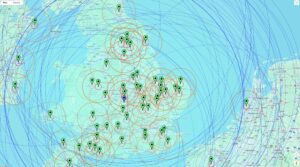
A free, cloud-based community NTRIP Caster that serves as a central hub for distributing high-precision GNSS correction data. Built on

Un montón de mapas SVG gratuitos del mundo, países o regiones, listos para descargar y utilizar en cualquier sitio web.

Te da en un mapa interactivo de la trayectoria del sol en cualquier lugar de la tierra en cualquier momento y cualquier