방사역방사 지도
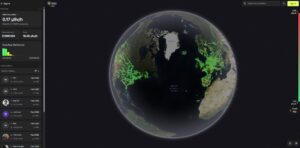
An interactive worldwide radioactivity / radiations map made by customers of the “RadiaCode” connected products recording their local area/path automatically
An interactive worldwide radioactivity / radiations map made by customers of the “RadiaCode” connected products recording their local area/path automatically
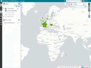
CentipedeRTK is a collaborative network of open GNSS bases available to anyone within the coverage area. The network is extended
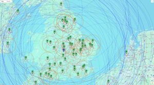
A free, cloud-based community NTRIP Caster that serves as a central hub for distributing high-precision GNSS correction data. Built on

A lot of free SVG maps of world, countries or regions, ready to be downloaded and used on any website

It gives you on an interactive map of the sun trajectory everywhere on earth at any given time and any