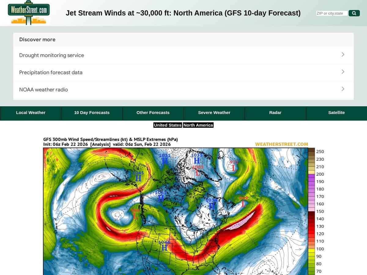
ジェット気流の位置と強さ、および風速(ノット)の現状と10日間の予報。 The WeatherStreet GFS Jetstream Wind Forecast provides high-altitude meteorological data visualizing wind velocity and direction at the 250 mb pressure level across North America. Utilizing the Global Forecast System (GFS) numerical model, the service generates a series of synoptic charts that track the polar and subtropical jet streams over a multi-day forecast horizon.
対象地域は北米と南米の一部です。より詳細な地域情報が必要な場合は、米国のみに絞り込むことも可能です。
高地での活動や、長時間にわたる天体写真撮影に役立ちます。 航空宇宙エンジニアや飛行運用スペシャリストは、これらの予測を利用して大陸横断飛行経路を最適化し、追い風を活用して燃料消費量を削減し、構造的完全性を確保するために潜在的な晴天乱気流域を特定します。科学およびイノベーションの分野では、このデータは以下の用途に活用されています。
- Predicting the trajectory and intensification of mid-latitude cyclones that disrupt manufacturing supply chains and logistics.
- 空中風力発電(AWE)システムの革新に向けた、高高度における運動エネルギーのモデリング。
- Analyzing atmospheric blocking patterns to forecast extreme temperature events affecting industrial cooling and energy grid loads.