To trigger an action when a device enters or exits a virtual boundary.
- 方法: 人体工程学
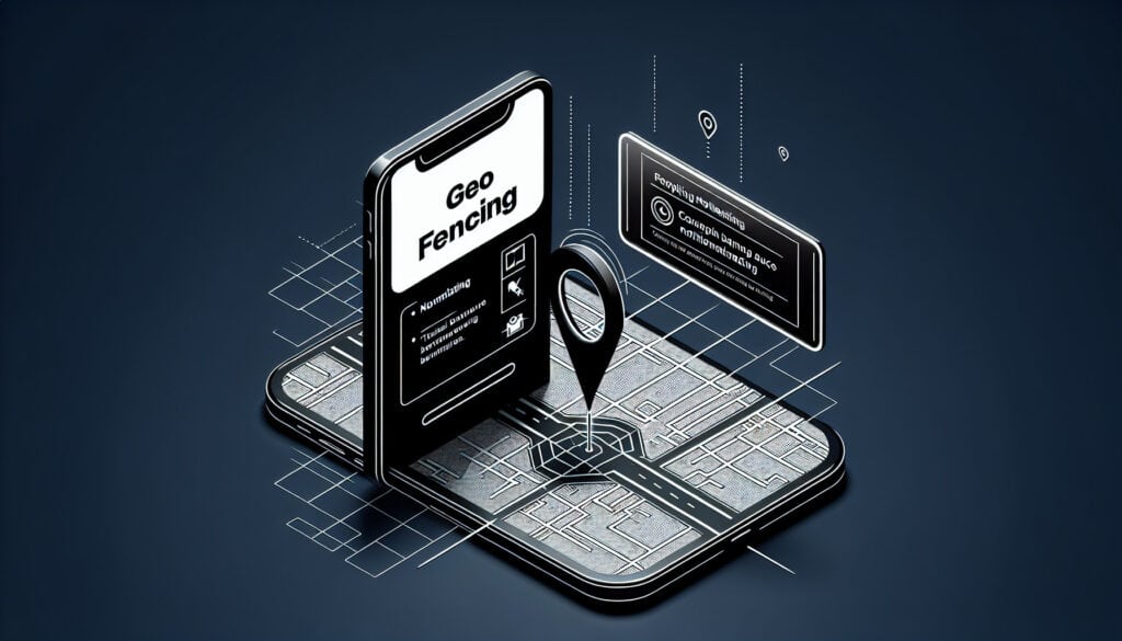
Geofencing
- 客户体验, 數位行銷, 地理信息系统(GIS), 全球定位系统(GPS), 营销, 射频识别, 用户体验(UX), 用户界面(UI)
Geofencing
- 客户体验, 數位行銷, 地理信息系统(GIS), 全球定位系统(GPS), 营销, 射频识别, 用户体验(UX), 用户界面(UI)
目标
如何使用
- A location-based service in which an app or other software uses GPS, RFID, Wi-Fi or cellular data to trigger a pre-programmed action when a mobile device or RFID tag enters or exits a virtual boundary set up around a geographical location, known as a geofence.
优点
- Allows for highly targeted and timely marketing messages; Can drive foot traffic to physical stores.
缺点
- Can raise privacy concerns; Effectiveness depends on users having location services enabled.
类别
- 客户与营销
最适合:
- Sending a promotional message to a customer's phone when they are near a retail store.
Geofencing technology finds wide application in retail, real estate, transportation, and event management industries, enhancing customer engagement and operational efficiency. During the design and development phase, integrating geofencing can involve collaboration among product managers, developers, and marketing teams to create strategic guidelines for location-based offerings. For instance, event organizers can leverage geofencing to boost attendance by sending notifications or reminders to attendees as they approach the venue, while real estate agencies might notify potential buyers regarding available properties in their vicinity. During a project’s initiation phase, stakeholders must define clear objectives regarding user experience and desired outcomes, ensuring that privacy concerns are addressed through transparent communication about data usage. In the transportation sector, companies can improve their logistics by establishing geofences around distribution centers, triggering alerts when vehicles enter or leave designated areas, allowing for better management of operations and resources. In addition, geofencing can be employed in loyalty programs, where customers receive rewards upon entering a store, encouraging repeat visits and fostering a sense of community around brands. For successful adoption, the involvement of data analysts may be necessary to interpret user engagement metrics, which can further drive informed decisions for campaign adjustments and optimizations.
该方法的关键步骤
- Define geofence parameters such as radius and geographical boundaries.
- Implement GPS, RFID, or Wi-Fi technology to establish location tracking.
- Develop an application or platform to manage geofence triggers and responses.
- Create promotional content to be sent when users enter or exit the geofence.
- Integrate user consent mechanisms for data privacy compliance.
- Test geofencing functionality and ensure accurate area coverage.
- Launch the geofencing campaign and monitor performance in real-time.
- Adjust geofence parameters or promotional content based on user engagement data.
专业提示
- Integrate real-time data analytics to optimize geofence parameters based on customer behavior and foot traffic analysis.
- Test and refine messaging effectiveness by A/B testing different promotional campaigns within specific geofenced areas.
- Ensure compliance with privacy regulations by providing clear opt-in options and transparent data usage policies to users.
历史背景


1992
1996
1998
2000
2000
2003
2013-09-24
1992
1994
1997
1999-05-01
2000
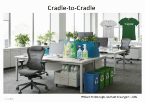
2002
2013


(如果日期不详或不相关,例如 "流体力学",则对其显著出现的时间作了四舍五入的估计)。
相关文章
制造运营管理(MOM)
制造执行系统(MES)
生产控制计划
人工测试
手动搬运评估表 (MAC)
手动任务风险评估工具(ManTRA)